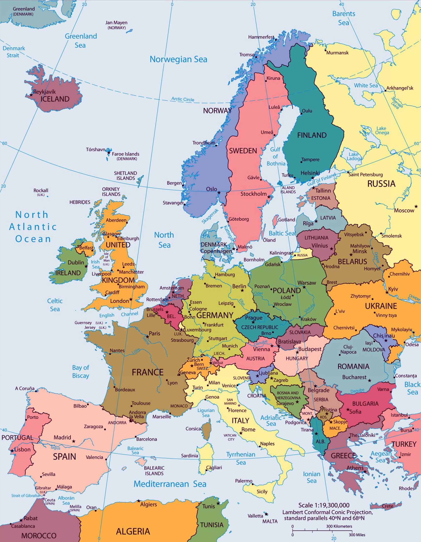
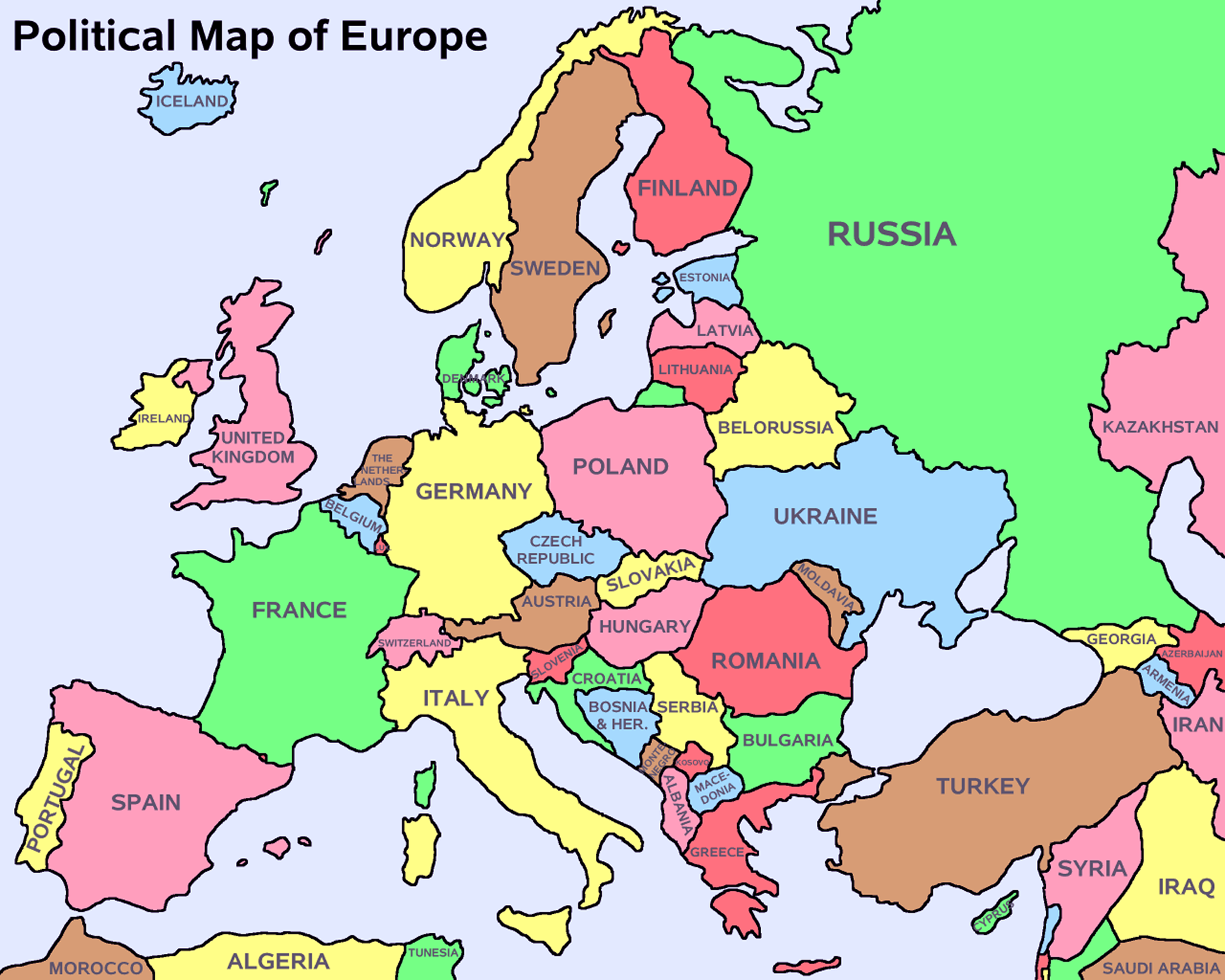
Large big Europe flag, political map showing capital cities
Hi my dear visitors and regular followers! As I had promised you earlier, saying that I will be publishing not only maps of countries but also maps of regions and continents such as Europe, Caribbeans, Anatolia, Scandinavia, Africa, Polynesia so on and so forth. Today I am starting that big project, haha 😀
Well, yea, I will be sharing two, big size, and detailed, colored political map of Europe. One of them showing also the capital cities of each European country. I edited both of them, trying -and hopefully achieving- to make them a little more convenient. I believe they are printable too, and if you would like to download the maps and print them for your own personal use, you are welcome to. They are free!
On the page, they appear to be small in size, please, just click on the pictures to see them in bigger, original sizes. Or, simply right click on them and save them in your computers, they will be saved as in their original larger sizes. So then you could view them at your own convenience in your PC or mobile gadget when you are offline.
If you have some sort of homework or project to work on the maps, you could do that too, for sure!


