Popular Atlantic Islands For Vacation
Atlantic Islands from Antarctica to the tropics; Here is a brief list of Atlantic Islands with lots of detail about them.Islands within the list includes those such as South Shetland Islands, Elephant Island, South Georgia, Bird Island, Tristan da Cunha, Gough, Nightingale, Inaccessible, St. Helena, Ascension Island, Boatswain Bird Island, Cape Verde
South Shetland Islands
The South Shetland Islands are of volcanic origin, but old enough to carry sediments, even with fossils. They form the southern part of the Scotia Arc, the island arc from the southern tip of South America to the Antarctic Peninsula runs through South Georgia, South Sandwich Islands and the South Orkney Islands.
The island range runs parallel to the northern coast of the Antarctic Peninsula. Most are on a line from southwest to northeast Low, Snow, Livingston, Greenwich, Roberts, Nelson and King George Island, the largest of all. Then follow after a gap of 200 km Elephant Island and Clarence Island. Low, Snow, Roberts and Nelson Island are low and entirely covered with a dome-shaped ice surface gradient, on all sides to reach the sea. Only here and there is a small piece of ice-free coast, where a rising hill, forcing the glaciers to the left and right out of the way on both sides to pass. For the rest of the coastline consists of ice walls, which constantly thundering noise chunks calving. Livingston, Clarence and Elephant Island are steeper and have higher and thus in the interior ice-free slopes. Livingston Island is the highest mountain (2400 m) and is very erratic formed. Clarence is just a very steep mountain, 1900 meters high, on one side with a nearly vertical wall almost to the top runs. Elephant Island has a number of peaks, the highest 900 m wide.
King George Island is big, but not so high (600-700 m). It’s like the low islands completely covered by an ice sheet, but stabbing several places bare rocks above it. Moreover, the coastline is very irregular and in places deeply cut. There are many places and many sheltered fjords ice-free edges, and the southwestern tip is a large flat ice peninsula, ideal for the construction of an airport. This makes King George Island to an ideal living place and it is also one of the most densely populated regions of Antarctica. Live here Chileans, Argentineans, Ecuadorians, Uruguayans, Peruvians, Brazilians, Poles, Russians, Chinese, Koreans and Americans. Not long ago, there were also English and (very briefly) Italians. Chileans and Argentines both islands to count their territory, but the Chileans to King George the best position: they have their base at the airport, who is also the largest. Whom one of the other bases gets something too serious for its own doctor, is in the Chilean hospital. The Poles and Brazilians get their mail delivered at home by Chilean helicopter. That the British South Shetland Islands as British territory considered, no one really plays a role.
Series between the island and the mainland over a crack through the ocean floor, parallel to the islands. At three locations volcanoes occur here: Bridgeman, between Elephant Island and King George, Penguin Island, right on the south coast of King George Island, Deception Island, south of Livingston. Deception is horseshoe shaped, with a sheltered bay in the center. Some believe the island has a large caldera. Others believe that the horseshoe shape is a coincidence and that the ring consists of a chain of small volcanoes lying to each other. There is active volcanism: in 1970 there has been a real explosion, and it is still on the beach so you can take a hot bath at low tide by a pit dug in the sand and filled with melt water to percolate.
The South Shetlands are almost completely covered with ice. Only two to three percent of the country is free of ice. Usually, these stretches of the coast. This focus is all life: penguins, seals and the inhabitants of the various bases.
Elephant Island
Elephant Island is one of the easternmost islands of the South Shetlands. It is 60 km long and 40 km wide, and like the other islands, largely covered by ice. Flora and fauna are similar to the other islands in the region, but Elephant Island is a place with historical significance. Here is Sir Ernest Shackleton and all his men landed in the Weddell Sea after his ship, the Endurance, had perished. In an enhanced lifeboat he crossed to South Georgia, for help. After a terrible journey he landed on the south coast and had to have the entire island on foot crossing over glaciers and high mountain passes, the Norwegian whaling settlement Stromness reach. Ships to Elephant Island that were sent to relieve the others, had to return empty-handed three times because of ice conditions. Managed by a miracle fourth attempt, with everyone safely off the island was reached.
With Stinker Point, on the southwest side of the island, located a small creek that is called Wreck Bay. Here are some remnants of a sinking ship (I’m there in 1988 and I’ve seen them). Only in 1998 were recognized in the wreckage of the possible remains of Shackleton’s Endurance! South Georgia, Bird Island
South Georgia is located about 1000 km east of the Falkland Islands in the northeastern corner of the Scotia Arc. Although just about the same latitude as the Falklands, it is much colder. The island is largely covered with glaciers, sea level, although large parts are covered with lush grass vegetation. The island is mountainous, with many peaks exceeding 2000 m. The coastline is deeply indented fjords and countless walk a long way inland. South Georgia is a large island with a length of 200 km. The fjords, peaks, glaciers into the sea walk and the fresh green capes to South Georgia to a place of exceptional beauty. It is called the Himalayas to the South Atlantic called. Moreover, with superb the animals. Have been called the most famous king elegant pingu <ns, which nest in huge colonies, and the majestic giant albatross. Tristan da Cunha, Gough, Nightingale, Inaccessible
Tristan da Cunha (37 ° S, 12 degrees W) is about halfway between Cape Town and Buenos Aires in the emptiest stretch of ocean in the world on the edge of the Roaring Forties. The archipelago consists of the main island of Tristan da Cunha with his two satellites Inaccessible and Nightingale, and located 400 km south east Gough. Tristan is a circular volcano with a diameter of eleven kilometers and an altitude of 2000 meters. On all sides rise almost perpendicular walls from the sea, to a height of 300-600 meters. At the foot of the wall are several low plateaus. The largest of these is six kilometers long and half a kilometer wide. Here the 300 islanders living in a village called Edinburgh, but “The Settlement” is highlighted. Tristan was discovered in 1506 by the Portuguese in the seventeenth century, repeatedly visited by the Dutch in 1816 and eventually colonized by the British. Like on Ascension Tristan was a British garrison to prevent the French from there would try Napoleon from St. Helena to liberate. When the garrison withdrew in 1918 remained Corporal Glass with his wife, two children and friends behind. Shipwrecked adventurers and joined them, and women were removed from St. Helena, which brought a considerable amount of African blood. Many current Tristanieten have European facial features combined with a dark skin. The islanders live on potatoes, sheep, stamp sales and lobster fishing. Tristan has a cool, windy and wet climate. The vegetation is lush green and consists mainly of grasses, mosses, ferns and shrubs. Tristan itself is a result of human habitation have become poor in seabirds. More are available on the uninhabited islands of Inaccessible and Nightingale, about 40 km southwest of Tristan. At Nightingale, a diameter of just a mile has several million nesting pairs of great shearwaters, along with thousands of rockhopper penguins, yellow-nosed albatrosses, sooty albatrosses and more than a dozen other species of seabirds. In addition, two which endemic finch and a thrush. On Inaccessible nests also “Inaccessible flightless rail, ‘the smallest non-flying bird in the world. Inaccessible in 1994 declared an integral nature reserve. In Nightingale, the islanders of eggs and young of shearwaters harvesting. Although Gough less than 400 km away from Tristan, twice as much rain falls, it is cooler and it blows a lot harder. That’s because the subtropical convergence, a sharp boundary conditions on the high seas, much of the year exactly between the two islands continues. However, flora and fauna of Gough almost identical to that of the other islands of the Tristan group. The coast of Gough is very whimsical and inaccessible, with cliffs up to 900 meters height. There is a South African permanent manned station. Gough Island in 1976 as a whole declared a Wildlife Reserve in the highest category of protection. Besides millions of seabirds breed a separate check and a non-flying species of water fowl. A similar moorhen lived on Tristan in the last century. Of moorhens currently found on Tristan is not yet clear whether this original Tristan Gough imported chickens or chickens. On the beaches of the islands of the Tristan group life elephant seals and fur seals, whose populations after slaughter in the last century gradually recover. In the shallow waters around the islands of courting southern right whale. Administrative Tristan and Gough are among the British colony of St. Helena. Tristan can only be reached by ship. Usually this is about six times a year. St. Helena
St. Helena (16 degrees S, 6 degrees W) is located in the Southern Atlantic Ocean, about 2000 km north of Tristan da Cunha and about as far from the African coast. The island measures 10 by 17 km and is highly uneven. Originally it was a green, heavily wooded island, but since the discovery by the Portuguese in 1502, the original vegetation by goats and rabbits imported almost entirely destroyed.
Its pleasant climate and convenient location was St. Helena in the sixteenth and seventeenth centuries a major refreshment station for Oostindi ‰ boaters on the trip back to Europe. In addition, the island because of its isolated location for exiles, the most famous of which Napoleon was. On St Helena live about 5000 people, mostly in the only town Jamestown, which is wedged in a picturesque valley close to the sea. Many residents are descendants of former slaves, but there is also many Asian and European blood in the population. The island is a British colony since 1653. The Dutch took while it occupied in 1673, but the British recaptured the island in the same year. At sea level there is little rainfall (about 200 mm), but with the height, the precipitation increases rapidly. The onderste 300 m from the island are very dry and offer an almost desert-like appearance, but above that, to the 800 m high peak, the island is bright green, even though the original vegetation almost completely replaced by exotic plants. Most of the handful of species of land birds introduced (including the famous St. Helenafazantjes – a estrildesoort from West Africa). The only native land bird, the endemic ‘wire bird’, a pleviertje closely related with the African shepherd plover. Wire Birds are found mostly on high plains grazed by livestock. Also the zeevogelfauna of St. Helena is not much left. Here and there along the coastal cliff colonies noddy and tropic birds to find and some detached rocks are still small numbers of Pelicans on rock. The elegant white terns (fairy tern) have located in the city and breed on ridges of the windows of the church in Jamestown. Saint Helena has no airport. The only official connection to the outside world by ship, the RMS St. Helena, the island on its way from Cardiff to Cape Town calling six times a year. There is no port. Passengers are rowed in boats to the quay. If a lot of swell, this is not even possible. The RMS St. Helena and Ascension shipping also makes one or two times a year to Tristan da Cunha.
The South Shetland Islands are of volcanic origin, but old enough to carry sediments, even with fossils. They form the southern part of the Scotia Arc, the island arc from the southern tip of South America to the Antarctic Peninsula runs through South Georgia, South Sandwich Islands and the South Orkney Islands.
The island range runs parallel to the northern coast of the Antarctic Peninsula. Most are on a line from southwest to northeast Low, Snow, Livingston, Greenwich, Roberts, Nelson and King George Island, the largest of all. Then follow after a gap of 200 km Elephant Island and Clarence Island. Low, Snow, Roberts and Nelson Island are low and entirely covered with a dome-shaped ice surface gradient, on all sides to reach the sea. Only here and there is a small piece of ice-free coast, where a rising hill, forcing the glaciers to the left and right out of the way on both sides to pass. For the rest of the coastline consists of ice walls, which constantly thundering noise chunks calving. Livingston, Clarence and Elephant Island are steeper and have higher and thus in the interior ice-free slopes. Livingston Island is the highest mountain (2400 m) and is very erratic formed. Clarence is just a very steep mountain, 1900 meters high, on one side with a nearly vertical wall almost to the top runs. Elephant Island has a number of peaks, the highest 900 m wide.
Elephant Island is one of the easternmost islands of the South Shetlands. It is 60 km long and 40 km wide, and like the other islands, largely covered by ice. Flora and fauna are similar to the other islands in the region, but Elephant Island is a place with historical significance. Here is Sir Ernest Shackleton and all his men landed in the Weddell Sea after his ship, the Endurance, had perished. In an enhanced lifeboat he crossed to South Georgia, for help. After a terrible journey he landed on the south coast and had to have the entire island on foot crossing over glaciers and high mountain passes, the Norwegian whaling settlement Stromness reach. Ships to Elephant Island that were sent to relieve the others, had to return empty-handed three times because of ice conditions. Managed by a miracle fourth attempt, with everyone safely off the island was reached.
With Stinker Point, on the southwest side of the island, located a small creek that is called Wreck Bay. Here are some remnants of a sinking ship (I’m there in 1988 and I’ve seen them). Only in 1998 were recognized in the wreckage of the possible remains of Shackleton’s Endurance! South Georgia, Bird Island
South Georgia is located about 1000 km east of the Falkland Islands in the northeastern corner of the Scotia Arc. Although just about the same latitude as the Falklands, it is much colder. The island is largely covered with glaciers, sea level, although large parts are covered with lush grass vegetation. The island is mountainous, with many peaks exceeding 2000 m. The coastline is deeply indented fjords and countless walk a long way inland. South Georgia is a large island with a length of 200 km. The fjords, peaks, glaciers into the sea walk and the fresh green capes to South Georgia to a place of exceptional beauty. It is called the Himalayas to the South Atlantic called. Moreover, with superb the animals. Have been called the most famous king elegant pingu <ns, which nest in huge colonies, and the majestic giant albatross. Tristan da Cunha, Gough, Nightingale, Inaccessible
Tristan da Cunha (37 ° S, 12 degrees W) is about halfway between Cape Town and Buenos Aires in the emptiest stretch of ocean in the world on the edge of the Roaring Forties. The archipelago consists of the main island of Tristan da Cunha with his two satellites Inaccessible and Nightingale, and located 400 km south east Gough. Tristan is a circular volcano with a diameter of eleven kilometers and an altitude of 2000 meters. On all sides rise almost perpendicular walls from the sea, to a height of 300-600 meters. At the foot of the wall are several low plateaus. The largest of these is six kilometers long and half a kilometer wide. Here the 300 islanders living in a village called Edinburgh, but “The Settlement” is highlighted. Tristan was discovered in 1506 by the Portuguese in the seventeenth century, repeatedly visited by the Dutch in 1816 and eventually colonized by the British. Like on Ascension Tristan was a British garrison to prevent the French from there would try Napoleon from St. Helena to liberate. When the garrison withdrew in 1918 remained Corporal Glass with his wife, two children and friends behind. Shipwrecked adventurers and joined them, and women were removed from St. Helena, which brought a considerable amount of African blood. Many current Tristanieten have European facial features combined with a dark skin. The islanders live on potatoes, sheep, stamp sales and lobster fishing. Tristan has a cool, windy and wet climate. The vegetation is lush green and consists mainly of grasses, mosses, ferns and shrubs. Tristan itself is a result of human habitation have become poor in seabirds. More are available on the uninhabited islands of Inaccessible and Nightingale, about 40 km southwest of Tristan. At Nightingale, a diameter of just a mile has several million nesting pairs of great shearwaters, along with thousands of rockhopper penguins, yellow-nosed albatrosses, sooty albatrosses and more than a dozen other species of seabirds. In addition, two which endemic finch and a thrush. On Inaccessible nests also “Inaccessible flightless rail, ‘the smallest non-flying bird in the world. Inaccessible in 1994 declared an integral nature reserve. In Nightingale, the islanders of eggs and young of shearwaters harvesting. Although Gough less than 400 km away from Tristan, twice as much rain falls, it is cooler and it blows a lot harder. That’s because the subtropical convergence, a sharp boundary conditions on the high seas, much of the year exactly between the two islands continues. However, flora and fauna of Gough almost identical to that of the other islands of the Tristan group. The coast of Gough is very whimsical and inaccessible, with cliffs up to 900 meters height. There is a South African permanent manned station. Gough Island in 1976 as a whole declared a Wildlife Reserve in the highest category of protection. Besides millions of seabirds breed a separate check and a non-flying species of water fowl. A similar moorhen lived on Tristan in the last century. Of moorhens currently found on Tristan is not yet clear whether this original Tristan Gough imported chickens or chickens. On the beaches of the islands of the Tristan group life elephant seals and fur seals, whose populations after slaughter in the last century gradually recover. In the shallow waters around the islands of courting southern right whale. Administrative Tristan and Gough are among the British colony of St. Helena. Tristan can only be reached by ship. Usually this is about six times a year. St. Helena
St. Helena (16 degrees S, 6 degrees W) is located in the Southern Atlantic Ocean, about 2000 km north of Tristan da Cunha and about as far from the African coast. The island measures 10 by 17 km and is highly uneven. Originally it was a green, heavily wooded island, but since the discovery by the Portuguese in 1502, the original vegetation by goats and rabbits imported almost entirely destroyed.
Its pleasant climate and convenient location was St. Helena in the sixteenth and seventeenth centuries a major refreshment station for Oostindi ‰ boaters on the trip back to Europe. In addition, the island because of its isolated location for exiles, the most famous of which Napoleon was. On St Helena live about 5000 people, mostly in the only town Jamestown, which is wedged in a picturesque valley close to the sea. Many residents are descendants of former slaves, but there is also many Asian and European blood in the population. The island is a British colony since 1653. The Dutch took while it occupied in 1673, but the British recaptured the island in the same year. At sea level there is little rainfall (about 200 mm), but with the height, the precipitation increases rapidly. The onderste 300 m from the island are very dry and offer an almost desert-like appearance, but above that, to the 800 m high peak, the island is bright green, even though the original vegetation almost completely replaced by exotic plants. Most of the handful of species of land birds introduced (including the famous St. Helenafazantjes – a estrildesoort from West Africa). The only native land bird, the endemic ‘wire bird’, a pleviertje closely related with the African shepherd plover. Wire Birds are found mostly on high plains grazed by livestock. Also the zeevogelfauna of St. Helena is not much left. Here and there along the coastal cliff colonies noddy and tropic birds to find and some detached rocks are still small numbers of Pelicans on rock. The elegant white terns (fairy tern) have located in the city and breed on ridges of the windows of the church in Jamestown. Saint Helena has no airport. The only official connection to the outside world by ship, the RMS St. Helena, the island on its way from Cardiff to Cape Town calling six times a year. There is no port. Passengers are rowed in boats to the quay. If a lot of swell, this is not even possible. The RMS St. Helena and Ascension shipping also makes one or two times a year to Tristan da Cunha.
 Ascension Island, Boatswain Bird Island
Ascension Island is located 1100 km northwest of St. Helena, less than eight degrees south of the equator. It is a sun-scorched volcanic island, which at first glance not a blade of green can be discerned. Ash, lava and cinders alternate in variegation. Only on closer inspection reveal that the island is desert. Just as on St. Helena, the precipitation (mostly in the form of mist) with height. 500 m above the island is green and fertile, even above 700 meters. The island is over 900 m high.
Like St. Helena Ascension in 1502 discovered by the Portuguese, but because it was so barren and dry has never been of interest as a refreshment station for East Indiamen. However, goats and rabbits here immediately released, which as originally vegetation completely destroyed. As on Tristan at Ascension in 1815 a British garrison to Napoleon on St Helena ‘guard’. But because of its strategic location in the tropical Atlantic Ocean is the occupation remained, even after the death of Napoleon. In 1899, Ascension was a central position in the global communications through the laying of telephone cables on the ocean bottom from Cape Town to England, via St. Helena, Ascension and the Cape Verde Islands-cal. There were cables laid directly from Ascension to Sierra Leone in Africa, and Rio de Janeiro and Buenos Aires. The island remained a military post until 1922, when it became a dependency of St. Helena was and management was transferred to Cable & Wireless Ltd, the cables (and later radio) operated. Later I get the BBC and through contracts with the U.S., the U.S. Air Force and NASA. In the flat was an airfield built south, across a huge colony of colored tern. The terns are peacefully situated a short distance away. Although Ascension has been inhabited continuously since 1815, has never had permanent residents. There were only contractors and their families. This was true even for the high farm was located in the green mountains to the other residents to provide fresh vegetables. Ascension once had millions of seabirds, but mismanagement by practically all gone. Only the remaining guano deposits us. The soldiers arrived soon after 1815 with rats. That led the navy to fight cats, wild and immediately collapsed on the seabirds. In order to tackle the cats, dogs were introduced, which chased everything except cats. The result was an almost total eradication of all seabird species. Only the spotted terns (wideawakes ‘- Ascension is also called “Wide Awake Island’) managed to maintain itself, thanks to the fact that the island two months per year total left, so the cats as lean time gave that so scarce were enough. On Ascension are no indigenous land birds. What is flying around is introduced. In previous centuries there was a non-flying for ralletje, closely related to the Inaccessible flightless rail, and known only from a description from a travel journal of 1656 and skeletal finds from this century. Seabirds breed still plentiful on isolated rocks off the coast, in particular Boatswain Bird Island, which includes three types of rock pelicans, two species once king of birds, noddy and the endemic Ascension frigate birds nest. The beaches of Ascension are a large part of the year visited by sea turtles who lay their eggs. Cape Verde
The Cape Verde Islands are located 500 km west of the African coast, approximately the height of Cap Vert in Senegal. There are 10 inhabited islands and numerous uninhabited larger smaller seabird populations where there is decent housing. The islands were Portuguese, but now form a (poor buitengeoon) independent African nation. They are a continuation of the Sahel, with very little rainfall, which is also very irregular. Years of devastating drought followed by a huge downpour, which for many years all the rain in a few hours coming down. The islands are very different in character. Some are flat and desert-like, others are very rugged and mountainous. The highest peak is located on the island of Fogo, an active volcano which extends to 2800 m altitude, with the most remarkable black landscapes. The caldera at 2000 m altitude, even cultivate grapes for a local wine.
Sea birds are endemic to the Cape Verde shearwater, brown gent, the frigate bird, the Red-billed tropic birds and many species of smaller petrels. The endangered Fae’s Petrel breeds in the mountains. Unfortunately, the locals believe that the fat of the animal a therapeutic effect.
Related Posts
-
 Istanbul from A to Z; Complete Istanbul Guide
5 Comments | Jun 10, 2011
 -
 Hello Friends…
No Comments | Apr 3, 2009
 -
 Six Flags Great Adventure, The Biggest, The Fastest, The Most
No Comments | Apr 17, 2011
 -
 Mount Rushmore, The Monument
1 Comment | Apr 8, 2011
About The Author
Hasan
Trip & Travel Advisor; Voyager!
2 Comments
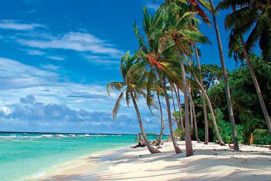

That’s right, dude! Most of us know and hear a lot about Pacific Ocean islands but here are Atlantic Ocean islands for vacation! Awesome!
That’s right, people! There a lot of gorgeous islands in the Atlantic, except for those that are well known.